
Support forestry projects with practical field planning, mapping, and review packages that make work easier to execute on the ground.
Field Layout & Engineering Support#
We provide the boots-on-the-ground support required to move projects from preliminary planning to physical execution. We hang the ribbon and gather the precise field data needed to support engineering design and professional review.
Field services include:
- Physical harvest block layout, boundary marking, and riparian flagging
- Road engineering, deflection line running, and road grade profiles
- High-accuracy GPS/GNSS feature capture and ground-truthing
- Site documentation and spatial verification
Visual Impact Assessments (Field & Regulatory)#
We support projects where visual outcomes are critical by gathering precise field data and managing the regulatory reporting process. (For general procedural modeling and photorealistic rendering, see our 3D Visualization Services).
VIA field support includes:
- Establishing precise RTK/GNSS ground control for accurate sightlines
- Viewpoint photography and site documentation
- Formatted regulatory reporting and professional submission packages
Professional Review Support#
We bridge the gap between field collection and final professional approval, ensuring all spatial data and documentation meet regulatory standards.
Review preparation includes:
- Engineering & Block Packages: Assembling clean, structured data sets that make review and rationale generation efficient.
- Documentation Prep: Organizing site plans and spatial evidence to support professional stamping requirements.
- Safety & Compliance: Integrating required health and safety checklists directly into the project documentation workflow.
Get in Touch
If a project needs to bridge field work, engineering review, and mapping output, we can help keep those pieces connected.
Related Services & Past Projects

Drone Surveying & Aerial Imaging
LiDAR point cloud collection, thermal imaging, and high-resolution orthomosaics.
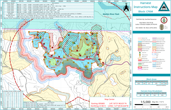
NICF Operational Map & Spatial Data Package
A comprehensive cartographic and spatial data package designed to support forestry engineering, safety, and appraisal submissions.