
Project Overview#
This portfolio piece highlights a complete forestry operational map package developed for the North Island Community Forest (NICF) LP. This overview details the standardized cartographic deliverables and digital spatial data required to move forestry developments from the engineering phase to active field operations, permitting, and silviculture.
The complete deliverable package ensures logging contractors, road builders, and government agencies have precise, legible, and compliant spatial information.
Cartographic Deliverables#
The visual component of the package consists of five distinct map types, each tailored to a specific operational phase.
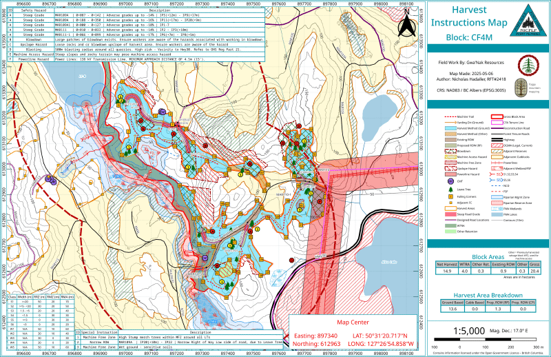
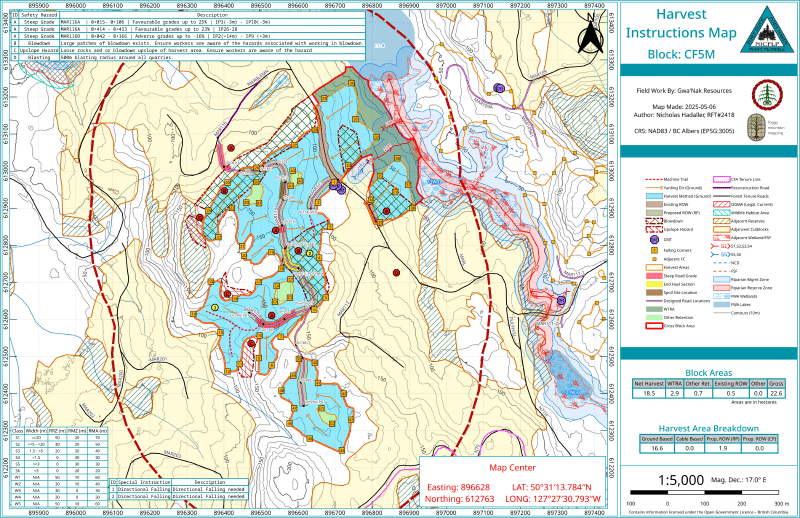
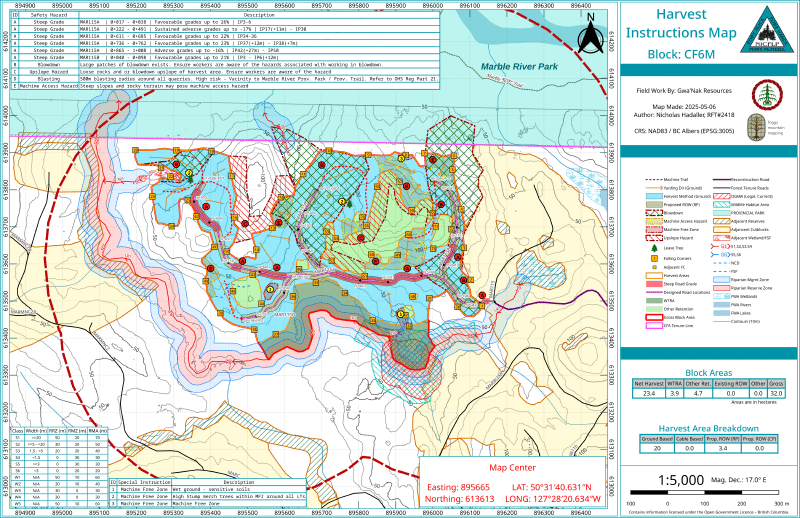
1. Harvest Instructions Map#
Designed directly for the logging contractor, this map strips away unnecessary engineering data to focus on harvest execution.
- Boundary & Right-of-Way Management: Clearly defines gross block areas, net harvest areas, and right-of-way (ROW) boundaries.
- Harvest Method Design: Delineates specific harvest methods (e.g., ground-based vs. cable) and identifies directional falling requirements.
- Retention & Riparian: Highlights Wildlife Tree Retention Areas (WTRA), individual leave trees, and established Riparian Management/Reserve Zones.
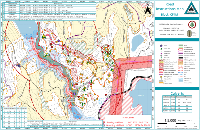
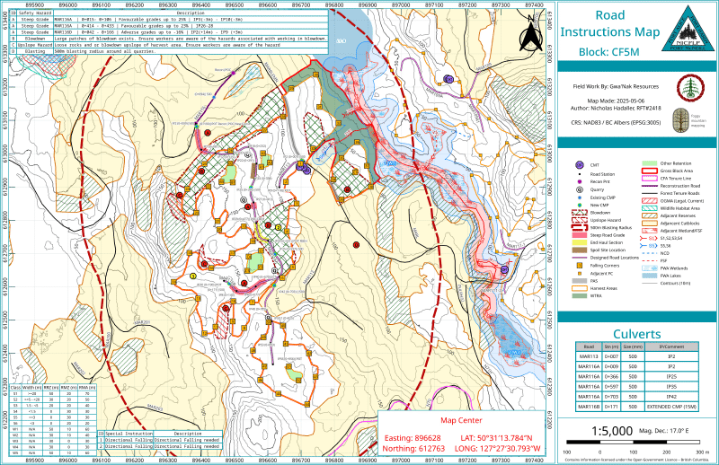
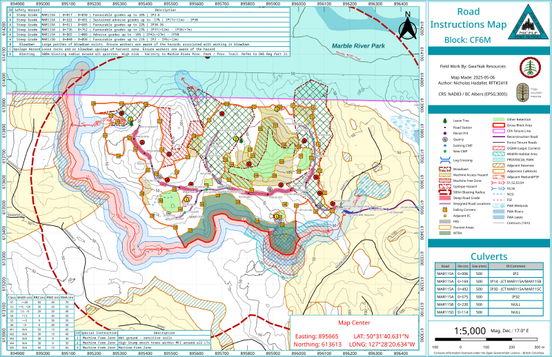
2. Road Instructions Map#
This map guides new subgrade construction and road development.
- Alignment & Grades: Details the engineered road locations, switchbacks, and specific road grades highlighting sustained adverse or steep favourable pitches.
- Road Point & Centerline Geometry: Maps exact road points (IPs) for field navigation and identifying crossing locations, junctions, etc.
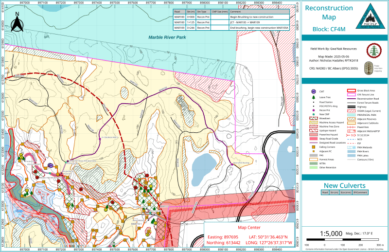
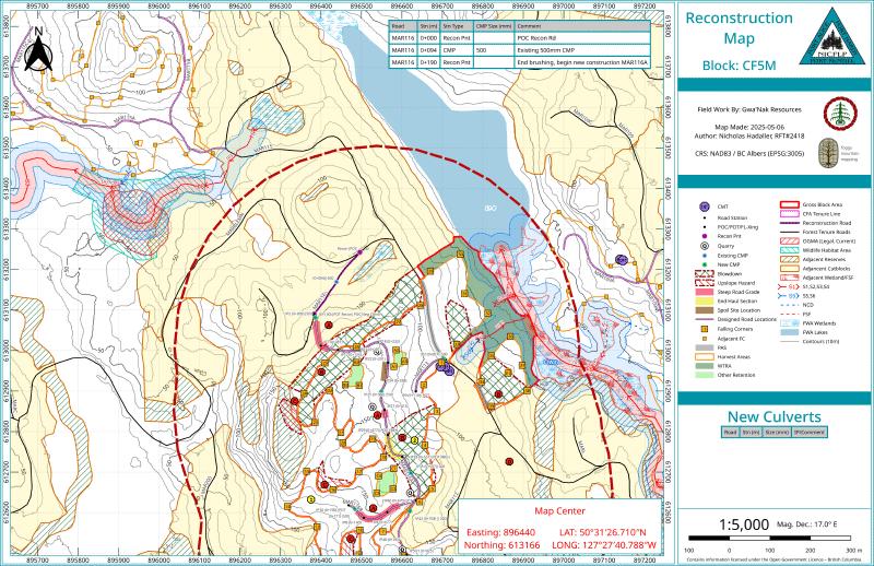
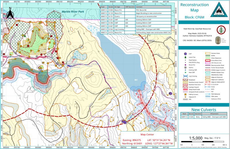
3. Road Reconstruction Map#
Used when upgrading existing infrastructure to support active hauling.
- Structure Management: Identifies locations for new crossing structures and prescribes mitigation for failing structures, such as overspanning existing wood box culverts WBC.
- Clearing: Marks exact stations for the commencement and termination of road brushing and new construction.
- Reactivation: Highlights areas of existing road that require reactivation, including clearing, ditching, and surfacing.
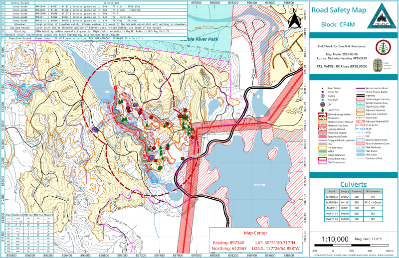
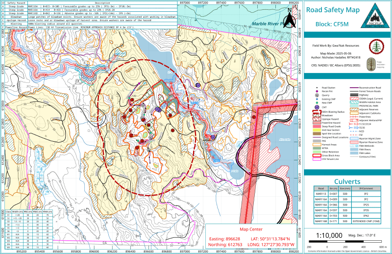
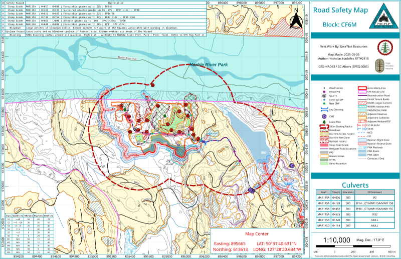
4. Safety & Hazard Map#
A dedicated map highlighting critical worksite constraints to ensure compliance with occupational health and safety regulations. Safety features are also identified on other maps to ensure field crews are aware of hazards during active operations.
- Industrial Hazards: Enforces safety boundaries, such as 500m blasting radii around quarries, and identifies overhead powerline hazards.
- Environmental Hazards: Highlights areas of heavy blowdown, steep machine access limitations, and upslope loose rock hazards.
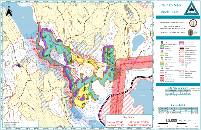
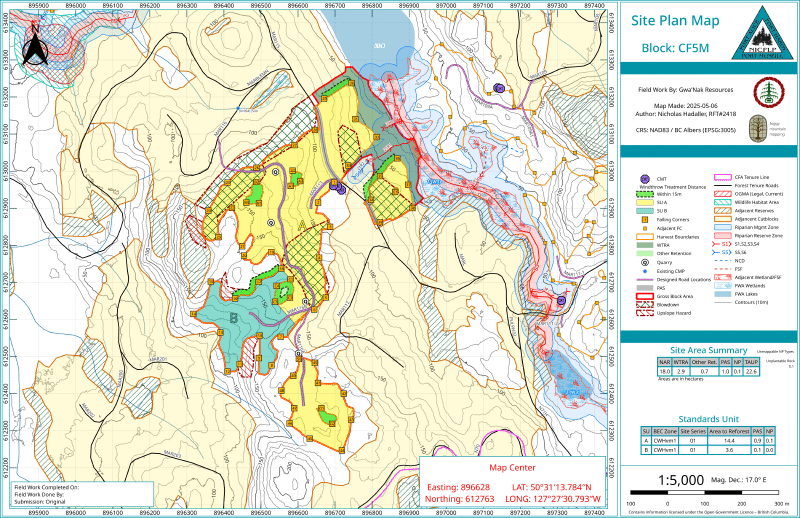
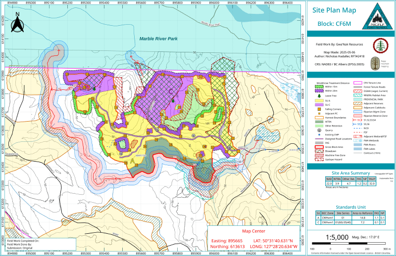
5. Site Plan & Reforestation Map#
Developed for the post-harvest silviculture phase, this map supports planting and legal reforestation obligations.
- Ecology: Maps specific Biogeoclimatic (BEC) zones and variants (e.g., CWHvm1) as identified by site plan forester.
- Area Calculation: Delineates Standards Units (SUs) and identifies unplantable areas (like rock outcroppings) to calculate the precise Net Area to Reforest (NAR).
- Adjacent Site Plan Amendments: Spatially edit and update adjacent site plan boundaries to reflect the most current harvest and road development extents, ensuring that surrounding site plans remain accurate and compliant with regulatory requirements.
Digital Spatial Data Package#
Beyond the PDF cartography, a robust GIS data package is generated to support downstream corporate systems and government submissions.
Appraisal Spatial Data#
To support the timber pricing and stumpage rate calculations, a clean topological dataset is prepared for the submission to the Ministry of Forests. This includes strict geometric validation of:
- NAR + PAS + Retention areas prepared into TAUP polygons for submission to the Ministry of Forests.
- Harvest blocks and cruise type polygons matched perfectly to the cruise compilation.
- Road development lines segmented by construction category (new build, reconstruction, end-haul).
- Accurate point data for specified operations (e.g., culverts, bridges, and rock pits).
- Site plan SU polygons and any amended adjacent site plan boundaries to ensure the NAR is accurately calculated.
Operational Spatial Data#
A comprehensive Geodatabase (or structured shapefile directory) is compiled for the client. This master dataset contains the authoritative linework for all mapped features, ensuring the client’s internal GIS architecture remains up-to-date with the newly engineered block boundaries, retention areas, and road networks.